Planning a Passage to meet a Greek goddess
- Peter

- Aug 29, 2021
- 9 min read
Updated: Sep 1, 2021
Having begun to develop an affinity with Odysseus by following his ancient voyage through the Straits of Messina we began to understand how he may have felt without a 110 HP Yanmar engine, bow thruster, satellite phone and a modern navigation system onboard his ship.

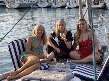
We thought that maybe it was time to further strengthen our ties with him. You may ask how we can do this in this modern age ?? Well, though we live in 2021, our imaginations are still quite fertile and we (at least I) remember stories of Greek goddesses, sirens, oracles and beasts that mere mortals need extra help to defeat. The next necessary steps to move forwards with this new plan was to prepare a voyage to his homeland of Greece for our adventures to continue. In addition, Kathy my sister and her family were expected on Corfu for a holiday, so it was also a great opportunity to meet up with them while we continued to follow our adventure.
Planning a voyage is not only common sense but it is actually a legal requirement under the laws SOLAS (Safety of Life at Sea) for all vessels. The law requires a written plan that is suitable for the voyage to be undertaken and something that must be available for the crew to be able to read. The process starts very simply by deciding where we want to go to from our current position – and so the basic concept of distance and how many days it will take is defined. However, this is where the simplicity ends and the next steps are to flesh out the trajectory with information such as weather, wind, wave heights, ocean currents and swell direction.

In our own methodology we make a plan that has a way point every 6 hours. We have set our average speed at 5 knots per hours, hence distance sailed per 6 hours is roughly 30nm, so we know when we will be along our planned path. Obviously, there are parts of the journey where we go faster, but also parts where we may go slower.
A week before setting off we start to note down the weather for the different areas where we hope to be and see how the weather pattern is developing. The main weather ingredients are wind direction (can we sail to our destination), wind strength (do we leave or stay put), wave height (overall safety) and wave direction (comfort).

Once we have calculated the total sailing time, we base our departure time on our preferred arrival time. The importance with this is that we want to arrive at our destination in daylight hours.
We have found that the major weather models in the Mediterranean Sea are at best “poor” to “seriously incorrect”. We therefore supplement the models with local weather forecasts to get a complete weather forecast to make the final decision as to “yes, we will go” or “no, we will not go”. Somehow the fine tuning can be quite different from what is predicted. If we see high winds, wind in the wrong direction or any risks such as thunder storms, then we simply wait until there is a suitable weather window that we can happily accept.
If you remember, for our passage from Brest to Portugal earlier this year, we had to wait 5 months for a safe window that would allow us to make our voyage. For us, this was based on both safety and comfort as we did not want to risk storms, cold weather and the short winter days where there would be more darkness than light in the day. This was an extreme wait and necessary for such a long journey, but it was important for us not to head off until the conditions were suitable.
Our shorter passages follow this iteration process of daily checking until the conditions are suitable. We do not want to risk damage to our boat from high winds or to risk our own lives: sailing is supposed to be fun !
Our own criteria are not to set off if there is a forecast of winds greater than 20 knots (force 5) and waves greater than 2 metres. We do accept that this may occur on the way, but for planning purposes we tend to err on the conservative side. The only exception is that if the wind is behind us, we can accept a greater strength (true wind speed minus the boat speed give an apparent wind speed).
We inspect the planned route in great detail for any hazards, such as wrecks, rocks, shallows, sand bars, fish farms, exclusion zones, shipping lanes etc. especially close to departure and destination areas close to land.
Land marks, buoys, depths and other information to help identify our position are also noted for the route as a cross check to the electronic plotting system (that does everything as long as it works, and they are very, very reliable).
Along the route we also look at the closest ports we can get into, should it be necessary for weather, health or mechanical reasons. It is always good to make sure there is a plan B for a safe harbour with the facilities to accept us, should there be a need, rather than searching for a harbour in a time of stress.

The last part of the planning is the execution of the journey. Our weather forecasts are updated every 12 hours to give us a better idea of what is to be expected. We have a satellite system that allows us to log into our weather account and have an update whilst sailing, even if we are hundreds of kilometres from the nearest mobile phone system. We have unlimited data and 120 minutes of phone – should it be necessary. Our planning is therefore “live and modifiable”, should weather conditions change and we need to adapt our plans to keep our vessel safe.
You can see how our actual path is different from our planned path as we use the actual wind and weather to optimise our route.

On the more detailed plot, you can see where we followed the wind, giving a wavy path. As the wind veered too much to the east, so our path deviated from where we wanted to go, it was not possible to make a correction in direction and maintain a good sailing speed. Being almost 10 miles off our route (about 2 hours of sailing time) we corrected our position with a short time using the engine. After this, we were able to continue sailing in the right direction at a good speed.
Our position is automatically plotted on our electronic chart, but we also plot our position on a paper chart and take note of our Latitude and Longitude on an hourly basis. Knowing where you are and where you have been is important should there be an electronic failure, after which it is possible to find a safe port without electronic aids.

We also need food and water for our journey and our house rule is no alcohol while sailing as we need to keep a clear head at all times – just in case.
We have a water maker that makes fresh water out of salt water – so we will never run out and we also have sufficient for our comforts such as showers, washing, toilets and cooking.
For food we have a large stock of pasta, rice, beans and lentils, we have frozen bread, tins of what we like and a stock up of fresh vegetables and fruit before we depart.
Depending on sea conditions we either take the time to cook every day or, if it is a little rough, the we have a stock of pot noodles as our comfort food.
We need to be up and vigilant for 24 hours a day, this is necessary to avoid collisions with other vessels, fishing nets and also to keep the correct sail plan that suits the wind and weather conditions. There is not a moment that we are not looking around to see what is happening around us.
Ingrid prefers the day light for being on watch and I am happy for the nights, so we split our shifts accordingly, giving each other plenty of time for rest and time for out watches both day and night.
Our AIS system (Automatic identification System) allows most commercial boats to be “seen” from a distance of up to 50 miles, giving plenty of time to make collision avoidance (the sea ways are busy and there is inevitably boats that cross, follow or cut across out path).
Only fishing boats (they don’t want to share their perfect fishing spots with other fishermen) and other smaller yachts often don’t have this system, so it is important to be vigilant.
We also have a radar system that detects other vessels, so even if they do not have an AIS, they can be tracked and any risk of collision is avoided.
The sea laws state that “steam” gives way to “sail”. In reality it is correct and followed, except for commercial vessels such as ferries and by fishing boats who have a right of way. However, our SOLAS rules also state that collision avoidance is the responsibility of both parties, so no excuses, under any circumstances are allowed.
Being realistic, a large vessel may not easily see a small vessel, which is why our AIS is always turned on so there is no doubt that we can see each other. Should things not look like they are following correct procedures, there is also the VHF that can be used to contact oncoming vessels and we can ask them of their intentions.
Our most recent passage from Ragusa in Sicily to Corfu City was planned to be 350 nautical miles, which then split up to taking 4 days and 3 nights of sailing. We left Sicily at 4pm, so we could arrive in the early afternoon, 4 days later, giving room for an increase in speed or a decrease in speed, depending on the weather.
We did get off to a good start with a light wind on our beam, but this dropped off as the sun started to go down and it was necessary to start the engine to keep us somewhat to our schedule (already thinking of our arrival time). Ingrid took the evening shift and I planned to come back at midnight. Fortunately, the moon was almost full and so there was plenty of light in the night and for all the nights of our passage. With the year progressing the evenings come earlier and the mornings later, so by 8.30 PM the sun had gone down and was not due back to 6.30 in the morning.
The following day we had some hours of sufficient wind to sail and even a few hours of sailing without the engine is such a pleasure, even if we only sail at 4 knots per hour.
We tried to sail with the best speeds, even changing our direction to optimise this, knowing that we had time to correct our path and position in the days ahead. However, we did keep to within 10 miles of our planned route.

Just before we had one 12-hour period where the wind did blow 2x stronger than predicted/expected. As the wind increased, I steadily reduced the sail area to maintain a speed of 5-7 knots as there is just too much power in the full sails with +20 knots of wind. The boat can be uncontrollable, dangerous and be damaged. There is an old adage that if you think it is necessary to reef the sails (reduce the sail area) then it is already too late – the moral is to be ready well in advance for safety and comfort.
With our motorised in-mast furling and electric winches for the genoa, reefing the sails is a quick and easy job (even for Ingrid) so we take in and let out the sails on a regular basis to match the conditions and maintain our speed.
With the strong winds we also had some large waves building up. The forecast was 10-12 knots of wind and 80 cm of waves. We had 20 – 24 knots of wind and waves of about 2 metres – though not easy to measure. It is a little frightening to see the power of nature at work and our little boat cruising through the turbulent waters. We have come to understand that the boat can actually handle a lot more than we can, so we rest in this security as the waves get higher and the wind gets stronger !
Ocean traffic was surprisingly light throughout our journey and there were only a few occasions that we needed to change path to avoid some fishing boats. Unfortunately, the fishing on my side was a non-event without even a bite during our passage. It is a good job that our diet is plant based as the replenishment from my fishing efforts are not very productive. With the stronger winds we managed to catch up on our time curve and our estimated arrival time was midday on the 4th day.


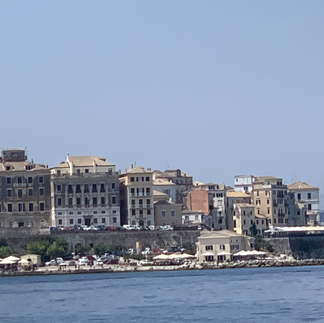

Sailing into the straits between Corfu Island and the Greek mainland, the waters were calm, though full of sailboats at anchor in the bays. It was a beautiful arrival in Greece and the concerns of the wind and waves were long forgotten.

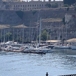
In the beginning as we approach Corfu City, all we can see is an indication of buildings in the distance. Without a close up of the actual port on the electronic chart, it is almost impossible to guess where is the entry to the harbour. We follow our planned route and slowly we begin to make out the details of harbour walls, masts and significant landmarks. It is almost to the point we have arrived that we begin to see actually where we are in reality.
The chart also helps us for arrival at night when things are even less clear and we need to sail by instruments alone.
Our final arrival in Mandraki Sailing Club Marina was at 1.00pm 4 days after departure – and only 1 hour later than originally planned. It was quite amazing that my imagined Greek Goddess was actually waiting for our arrival, stunningly dressed in black, looking out to see to wait for the arrival of our little ship. A smile and a tear of happiness that we were safe, though maybe this was just my imagination.

Our Greek adventures were really beginning and I wonder what tasks will be set before me as the gods welcome us safely home.


Comments